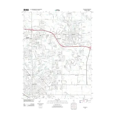
2012 Map of O'Fallon
USGS Topo · Published 2012About this map
The expanding suburban landscape of Belleville and O'Fallon in St. Clair County is defined by a dense network of residential streets and arterial roads like US Highway 50. This map captures a transition period where established communities such as Shiloh and Swansea are interwoven with older institutional markers, including the Saint Johns Orphanage Cem and the Belleville Area Junior College.
Find a feature on this map
59 named features on this map. Tap any name to fly to it.
Don’t see what you’re looking for? This feature index may not catch every label — zoom into the map to look around manually.
Map Details
Editions of this 2012 O'Fallon Map
This is the sole edition of this map. No revisions or reprints were ever made.
Other maps of this area

1888 · St. Louis
USGS Topo · 1:62,500

1907 · Belleville
USGS Topo · 1:62,500

1910 · Waterloo
USGS Topo · 1:62,500

1912 · New Athens
USGS Topo · 1:62,500

1913 · Waterloo
USGS Topo · 1:62,500

1931 · French Village
USGS Topo · 1:24,000

1935 · Lebanon
USGS Topo · 1:24,000

1935 · French Village
USGS Topo · 1:24,000

1935 · Monks Mound
USGS Topo · 1:24,000

1937 · Collinsville
USGS Topo · 1:24,000