
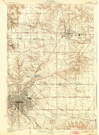
1937 Map of O'Fallon
USGS Topo · Published 1937About this map
The industrial corridor of St Clair County is meticulously documented in this 1930s survey, highlighting the coal extraction and transportation networks that defined the region's economy. Extensive mining operations such as the St Ellen Mine, Taylor Mine, and the St Louis & O'Fallon Mine are mapped alongside a dense web of rail lines, including the Baltimore and Ohio and the Illinois Terminal. The urban footprint of Belleville and O'Fallon shows established street grids, while the surrounding rural landscape is dotted with family and community landmarks like Messenger Cem and Whiteside Sch.
Find a feature on this map
55 named features on this map. Tap any name to fly to it.
Don’t see what you’re looking for? This feature index may not catch every label — zoom into the map to look around manually.
Map Details
Editions of this 1937 O'Fallon Map
2 editions found
Other maps of this area

1888 · St. Louis
USGS Topo · 1:62,500

1907 · Belleville
USGS Topo · 1:62,500

1910 · Waterloo
USGS Topo · 1:62,500

1912 · New Athens
USGS Topo · 1:62,500

1913 · Waterloo
USGS Topo · 1:62,500

1931 · French Village
USGS Topo · 1:24,000

1935 · Lebanon
USGS Topo · 1:24,000

1935 · French Village
USGS Topo · 1:24,000

1935 · Monks Mound
USGS Topo · 1:24,000

1937 · Collinsville
USGS Topo · 1:24,000