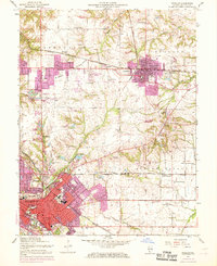
1954 Map of O'Fallon
USGS Topo · Published 1969About this map
The urban footprint of Belleville and O'Fallon expanded across the St Clair County landscape during the mid-20th century, a period of transition captured in this detailed topographic study. The industrial roots of the region are evident through features like the St Louis and O'Fallon Mine and scattered mine dumps, while the presence of Scott Air Force Base in the southeast indicates the growing military importance of the area.
Find a feature on this map
61 named features on this map. Tap any name to fly to it.
Don’t see what you’re looking for? This feature index may not catch every label — zoom into the map to look around manually.
Map Details
Editions of this 1954 O'Fallon Map
4 editions found
Other maps of this area

1888 · St. Louis
USGS Topo · 1:62,500

1907 · Belleville
USGS Topo · 1:62,500

1910 · Waterloo
USGS Topo · 1:62,500

1912 · New Athens
USGS Topo · 1:62,500

1913 · Waterloo
USGS Topo · 1:62,500

1931 · French Village
USGS Topo · 1:24,000

1935 · Lebanon
USGS Topo · 1:24,000

1935 · French Village
USGS Topo · 1:24,000

1935 · Monks Mound
USGS Topo · 1:24,000

1937 · Collinsville
USGS Topo · 1:24,000