
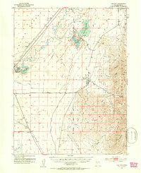
1951 Map of Oak City
USGS Topo · Published 1953About this map
Oak City sits at the transition between the arid Sevier Desert and the high elevations of the Fishlake National Forest. The settlement pattern in this 1951 survey is defined by the management of water and transportation through the valley. To the west, the Sevier River meanders toward the Delta Reservoir, while the Utah Central Railroad (Abandoned) traces a line through the Oak Creek Sinks, marking a shift in regional logistics as the active Union Pacific line serves the station at Harding.
Find a feature on this map
44 named features on this map. Tap any name to fly to it.
Don’t see what you’re looking for? This feature index may not catch every label — zoom into the map to look around manually.
Map Details
Editions of this 1951 Oak City Map
3 editions found
Other maps of this area

1885 · Sevier Desert
USGS Topo · 1:250,000

1952 · Scipio North
USGS Topo · 1:62,500

1953 · Delta
USGS Topo · 1:250,000

1958 · Delta
USGS Topo · 1:250,000

1962 · Delta
USGS Topo · 1:250,000

1962 · Lynndyl
USGS Topo · 1:62,500

1962 · Holden
USGS Topo · 1:62,500

1962 · Delta
USGS Topo · 1:62,500

1967 · Champlin Peak
USGS Topo · 1:24,000
1969 · Scipio Pass
USGS Topo · 1:24,000