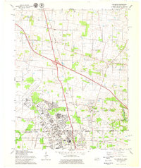
1979 Map of Oak Grove
USGS Topo · Published 1979About this map
Fort Campbell Military Reservation dominates the southwestern portion of this landscape at the close of the 1970s, showing a complex grid of military infrastructure including Helicopter Park and several gate access points. The border between Christian and Montgomery counties coincides with the state line between Kentucky and Tennessee, bisecting the community of Oak Grove and the residential area of Hensleytown. The map captures a moment of regional transition, where traditional rural landmarks like Salem Ch and Lester Memorial Ch sit near the modern expansion of trailer parks and the Drive-in Theater near the Illinois Central Gulf Railroad. Further south, Outlaw Field and several educational sites like Barkley High Sch indicate a developed institutional landscape supporting the military installation.
Find a feature on this map
59 named features on this map. Tap any name to fly to it.
Don’t see what you’re looking for? This feature index may not catch every label — zoom into the map to look around manually.
Map Details
Editions of this 1979 Oak Grove Map
2 editions found
Other maps of this area

1944 · Clarksville
USGS Topo · 1:50,000

1950 · Pembroke
USGS Topo · 1:24,000

1951 · Pembroke
USGS Topo · 1:24,000

1951 · Church Hill
USGS Topo · 1:24,000

1951 · Hopkinsville
USGS Topo · 1:24,000

1951 · New Providence
USGS Topo · 1:24,000

1951 · Hammacksville
USGS Topo · 1:24,000

1951 · Clarksville
USGS Topo · 1:24,000

1951 · Herndon
USGS Topo · 1:24,000

1951 · Oak Grove
USGS Topo · 1:24,000