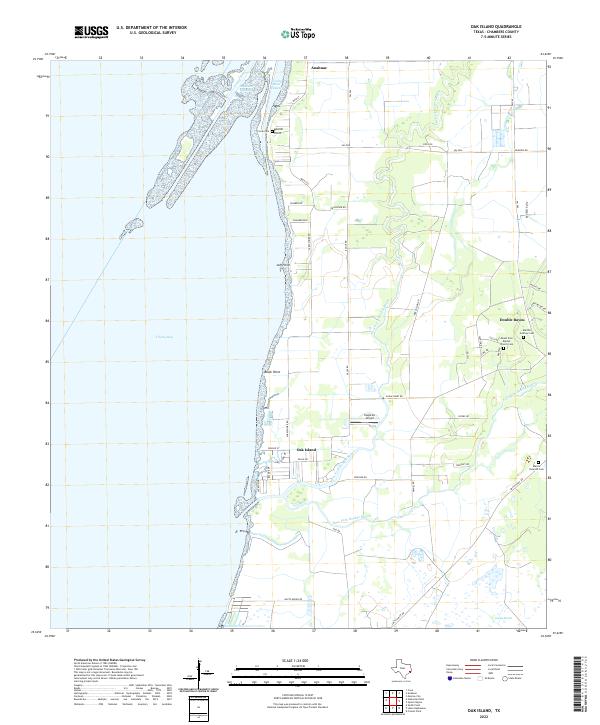
2022 Map of Oak Island
USGS Topo · Published 2022About this map
Anahuac and the coastal settlement of Oak Island anchor this survey of the eastern shores of Trinity Bay. The geography is defined by the complex aquatic network where the Trinity River Channel meets the bay, and where the West Fork Double Bayou and East Fork Double Bayou meander through low-lying coastal terrain. This landscape reflects a deep history of navigation and small-scale aviation, evidenced by Eagle Air Airport situated near the bayous. Several small family and church cemeteries, including Martha Godfrey Cem and the Martin Dunman Cem, are found near Double Bayou, providing essential markers for genealogists and local historians tracing the families who settled this part of Chambers County. To the south, the expansive Gordy Marsh illustrates the preservation of the natural marshy shoreline along the Texas Gulf Coast.
Find a feature on this map
51 named features on this map. Tap any name to fly to it.
Don’t see what you’re looking for? This feature index may not catch every label — zoom into the map to look around manually.
Map Details
Editions of this 2022 Oak Island Map
This is the sole edition of this map. No revisions or reprints were ever made.
Other maps of this area

1931 · Frozen Point
USGS Topo · 1:24,000

1933 · Frozen Point
USGS Topo · 1:31,680

1933 · Whites Lake
USGS Topo · 1:31,680

1933 · Smith Point
USGS Topo · 1:31,680

1942 · Anahuac
USGS Topo · 1:24,000

1943 · West of Eagle
USGS Topo · 1:31,680

1943 · Frozen Point
USGS Topo · 1:24,000
1943 · Smith Point
USGS Topo · 1:24,000
1943 · Lake Stephenson
USGS Topo · 1:24,000

1950 · Houston
USGS Topo · 1:250,000