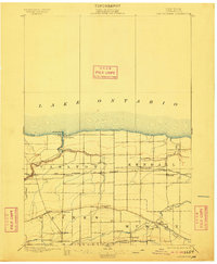
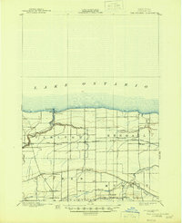
1897 Map of Oak Orchard
USGS Topo · Published 1911About this map
Lake Ontario borders the northern edge of this Orleans County landscape, where the mouth of Oak Orchard Creek is guarded by the Oak Orchard L.H. at Point Breeze. The interior reveals a dual transportation network that defined late 19th-century commerce: the Erie Canal cuts through the southern reaches near Hindsburg and Hulberton, while the Rome Watertown and Ogdensburg Line traverses the center, serving depots like Waterport Sta. and Carlton Sta.
Find a feature on this map
36 named features on this map. Tap any name to fly to it.
Don’t see what you’re looking for? This feature index may not catch every label — zoom into the map to look around manually.
Map Details
Editions of this 1897 Oak Orchard Map
6 editions found
Other maps of this area

1897 · Albion
USGS Topo · 1:62,500

1897 · Medina
USGS Topo · 1:62,500

1897 · Oak Orchard
USGS Topo · 1:62,500

1897 · Ridgeway
USGS Topo · 1:62,500

1899 · Hamlin
USGS Topo · 1:62,500

1899 · Brockport
USGS Topo · 1:62,500

1932 · Hamlin
USGS Topo · 1:24,000

1934 · Brockport
USGS Topo · 1:24,000

1935 · Hamlin
USGS Topo · 1:24,000

1944 · Holley
USGS Topo · 1:31,680