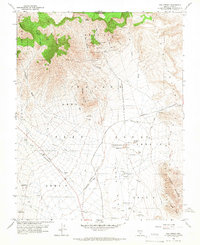
1960 Map of Oak Spring
USGS Topo · Published 1966About this map
Nevada Test Site operations dominate this 1960 landscape, where the Atomic Energy Commission and USGS documented a terrain fundamentally altered by nuclear testing. The map reveals the industrial and scientific infrastructure of the Cold War, featuring numerous bunkers, an Underground Telephone Line, and a series of deep exploratory wells including Drill Hole ME-4 and Drill Hole U 15-22.
Find a feature on this map
41 named features on this map. Tap any name to fly to it.
Don’t see what you’re looking for? This feature index may not catch every label — zoom into the map to look around manually.
Map Details
Editions of this 1960 Oak Spring Map
Other maps of this area

1908 · Kawich
USGS Topo · 1:250,000

1942 · Emigrant Valley
USGS Topo · 1:125,000

1942 · Wheelbarrow Peak
USGS Topo · 1:125,000

1952 · Tippipah Spring
USGS Topo · 1:62,500

1952 · Papoose Lake
USGS Topo · 1:62,500

1952 · Wheelbarrow Peak
USGS Topo · 1:62,500

1952 · Groom Mine
USGS Topo · 1:62,500

1954 · Caliente
USGS Topo · 1:250,000

1954 · Goldfield
USGS Topo · 1:250,000

1955 · Goldfield
USGS Topo · 1:250,000