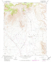
1960 Map of Oak Spring
USGS Topo · Published 1984About this map
Nevada Test Site Area 15 and surrounding sectors dominate this 1960 landscape, revealing the early infrastructure of the nation's nuclear testing grounds. Mapped by the Atomic Energy Commission, the terrain is marked by high-consequence landmarks such as Buster-Jangle Crater, Teapot Crater, and Scooter Crater. These craters and several designated blast centers sit in the shadow of Banded Mountain and the Eleana Range, illustrating the stark intersection of geological surveying and Cold War military operations.
Find a feature on this map
37 named features on this map. Tap any name to fly to it.
Don’t see what you’re looking for? This feature index may not catch every label — zoom into the map to look around manually.
Map Details
Editions of this 1960 Oak Spring Map
Other maps of this area

1908 · Kawich
USGS Topo · 1:250,000

1942 · Emigrant Valley
USGS Topo · 1:125,000

1942 · Wheelbarrow Peak
USGS Topo · 1:125,000

1952 · Tippipah Spring
USGS Topo · 1:62,500

1952 · Papoose Lake
USGS Topo · 1:62,500

1952 · Wheelbarrow Peak
USGS Topo · 1:62,500

1952 · Groom Mine
USGS Topo · 1:62,500

1954 · Caliente
USGS Topo · 1:250,000

1954 · Goldfield
USGS Topo · 1:250,000

1955 · Goldfield
USGS Topo · 1:250,000