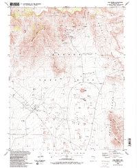
1986 Map of Oak Spring
USGS Topo · Published 1987About this map
The Nevada Test Site dominates this mid-1980s landscape, revealing the specialized infrastructure and topographical scars of atomic-age activity. Central to this survey are prominent craters such as Sedan Crater, Buster-Jangle Crater, and Teapot Crater, marking the floor of Yucca Flat. These features, alongside an extensive network of drill holes, illustrate the intensity of subsurface testing. The terrain transitions from the alluvial flats to the surrounding heights of the Halfpint Range and the Rhyolite Hills, where earlier resource extraction is noted by the Climax Mine and Climax Shaft. The map also details logistical and scientific outposts like the NTS Farm Complex, the Area 2 Support Facility, and several blast centers. This specific era of documentation captures a high-density industrial and military landscape at the peak of its Cold War operational utility, before major shifts in national testing protocols.
Find a feature on this map
40 named features on this map. Tap any name to fly to it.
Don’t see what you’re looking for? This feature index may not catch every label — zoom into the map to look around manually.
Map Details
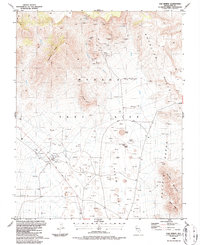
Editions of this 1986 Oak Spring Map
2 editions found
Other maps of this area

1908 · Kawich
USGS Topo · 1:250,000

1942 · Emigrant Valley
USGS Topo · 1:125,000

1942 · Wheelbarrow Peak
USGS Topo · 1:125,000

1952 · Tippipah Spring
USGS Topo · 1:62,500

1952 · Papoose Lake
USGS Topo · 1:62,500

1952 · Wheelbarrow Peak
USGS Topo · 1:62,500

1952 · Groom Mine
USGS Topo · 1:62,500

1954 · Caliente
USGS Topo · 1:250,000

1954 · Goldfield
USGS Topo · 1:250,000

1955 · Goldfield
USGS Topo · 1:250,000