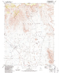
1986 Map of Oak Spring
USGS Topo · Published 1987About this map
Nevada Test Site infrastructure and geological scars dominate this 1980s landscape in Nye County. The map provides an industrial perspective on nuclear testing history, centered on the massive Sedan Crater and neighboring impact sites like Buster-Jangle Crater, Scooter Crater, and Teapot Crater. Beyond the craters, the terrain transitions from the volcanic Rhyolite Hills to the broad expanse of Yucca Flat. Scientific and support facilities are scattered throughout the region, including the N T S Farm Complex, various substations, and a Lookout Tower. Earlier mining efforts are also evident in the north, where the Climax Mine and Climax Shaft sit near Oak Spring. This collection of drill holes, mines, and blast centers reflects the mid-century transformation of the high desert into a highly specialized technological and military proving ground.
Find a feature on this map
41 named features on this map. Tap any name to fly to it.
Don’t see what you’re looking for? This feature index may not catch every label — zoom into the map to look around manually.
Map Details
Editions of this 1986 Oak Spring Map
2 editions found
Other maps of this area

1908 · Kawich
USGS Topo · 1:250,000

1942 · Emigrant Valley
USGS Topo · 1:125,000

1942 · Wheelbarrow Peak
USGS Topo · 1:125,000

1952 · Tippipah Spring
USGS Topo · 1:62,500

1952 · Papoose Lake
USGS Topo · 1:62,500

1952 · Wheelbarrow Peak
USGS Topo · 1:62,500

1952 · Groom Mine
USGS Topo · 1:62,500

1954 · Caliente
USGS Topo · 1:250,000

1954 · Goldfield
USGS Topo · 1:250,000

1955 · Goldfield
USGS Topo · 1:250,000