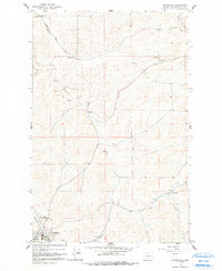
1964 Map of Oakesdale
USGS Topo · Published 1991About this map
The agricultural landscape of Whitman County is defined here by the winding course of Pine Creek and its many tributaries, including Cabbage Creek and McCoy Creek. The rail-era hub of Oakesdale sits in the southwestern corner, where the Northern Pacific railroad tracks parallel the water. Small settlements like Fairbanks, Seabury, and Lone Pine reflect the localized rural development of the mid-20th century.
Find a feature on this map
17 named features on this map. Tap any name to fly to it.
Don’t see what you’re looking for? This feature index may not catch every label — zoom into the map to look around manually.
Map Details
Editions of this 1964 Oakesdale Map
2 editions found
Other maps of this area

1903 · Oakesdale
USGS Topo · 1:125,000

1905 · Oakesdale
USGS Topo · 1:125,000

1954 · Spangle
USGS Topo · 1:62,500

1954 · Fairfield
USGS Topo · 1:62,500

1955 · Spokane
USGS Topo · 1:250,000

1958 · Spokane
USGS Topo · 1:250,000

1964 · Oakesdale
USGS Topo · 1:24,000

1964 · Tekoa
USGS Topo · 1:24,000
1964 · Steptoe
USGS Topo · 1:24,000
1964 · Garfield
USGS Topo · 1:24,000