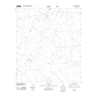
2010 Map of Oakhurst
USGS Topo · Published 2010About this map
The settlement of Oakhurst and nearby Palmetto Park anchor this portion of San Jacinto County, where the network of the East Fork San Jacinto River and its numerous tributaries shape the landscape. Rural development follows established routes like Old Dodge Rd and Felix Currie Rd, weaving between several historic burial sites that reflect the area's ancestral roots. These sites, including Center Hill Cemetery, Cleveland Cemetery, and Hoby Cemetery, are scattered across a terrain drained by Cobb Creek and Roark Creek. To the south, the Grace Lake Dam creates Grace Lake, a notable water feature amidst a topography defined by named branches and creeks such as Wheatfield Branch and Johnson Creek. The layout of forest service roads and local arteries like Willow Springs Rd provides a clear view of the rural homestead and timberland patterns established by the early 21st century.
Find a feature on this map
38 named features on this map. Tap any name to fly to it.
Don’t see what you’re looking for? This feature index may not catch every label — zoom into the map to look around manually.
Map Details
Editions of this 2010 Oakhurst Map
This is the sole edition of this map. No revisions or reprints were ever made.
Other maps of this area

1954 · Beaumont
USGS Topo · 1:250,000

1957 · Beaumont
USGS Topo · 1:250,000

1960 · Maynard
USGS Topo · 1:24,000

1960 · Carlisle
USGS Topo · 1:24,000

1960 · New Waverly
USGS Topo · 1:24,000

1960 · Stephen Creek
USGS Topo · 1:24,000

1960 · Coldspring
USGS Topo · 1:24,000

1960 · Phelps
USGS Topo · 1:24,000

1961 · Staley
USGS Topo · 1:24,000

1961 · Riverside
USGS Topo · 1:24,000