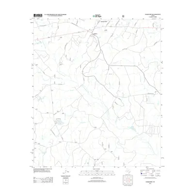
2013 Map of Oakhurst
USGS Topo · Published 2013About this map
The settlement of Oakhurst sits at the northern intersection of several local routes, serving as a hub for the surrounding landscape of San Jacinto County. This region is defined by the winding course of the E Fork San Jacinto River, which is fed by an intricate network of named tributaries including Deans Cr, Roark Cr, and McCombs Cr. For genealogists, the map is particularly valuable for its documentation of several rural burial grounds, such as Center Hill Cem and Cleveland Cem, which are tucked away along established backroads like Cleveland Cemetery Rd. The terrain is also dotted with private landmarks and small bodies of water, such as Grace Lake, reflecting a mix of residential development and traditional timber or ranch land. Recreational and community spaces are represented by Palmetto Park, located near the northern edge of the survey area.
Find a feature on this map
46 named features on this map. Tap any name to fly to it.
Don’t see what you’re looking for? This feature index may not catch every label — zoom into the map to look around manually.
Map Details
Editions of this 2013 Oakhurst Map
This is the sole edition of this map. No revisions or reprints were ever made.
Other maps of this area

1954 · Beaumont
USGS Topo · 1:250,000

1957 · Beaumont
USGS Topo · 1:250,000

1960 · Maynard
USGS Topo · 1:24,000

1960 · Carlisle
USGS Topo · 1:24,000

1960 · New Waverly
USGS Topo · 1:24,000

1960 · Stephen Creek
USGS Topo · 1:24,000

1960 · Coldspring
USGS Topo · 1:24,000

1960 · Phelps
USGS Topo · 1:24,000

1961 · Staley
USGS Topo · 1:24,000

1961 · Riverside
USGS Topo · 1:24,000