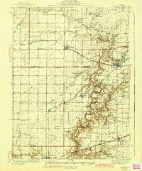
1942 Map of Oakland
USGS Topo · Published 1942About this map
The Embarrass River carves a deep, wooded path through the prairie of Douglas and Coles Counties, defining the agricultural landscape of the early 1940s. While the western portion of the sheet is marked by the orderly grid of the Pennsylvania and Chicago and New York railroads, the eastern terrain near Oakland becomes increasingly dissected by tributaries like Brushy Fork and Hog Branch. This contrast illustrates the transition between the flat upland till plains and the more varied topography of the river valley.
Find a feature on this map
89 named features on this map. Tap any name to fly to it.
Don’t see what you’re looking for? This feature index may not catch every label — zoom into the map to look around manually.
Map Details
Editions of this 1942 Oakland Map
2 editions found
Other maps of this area

1933 · Toledo
USGS Topo · 1:62,500

1934 · Mattoon
USGS Topo · 1:62,500

1935 · Arcola
USGS Topo · 1:48,000

1936 · Oakland
USGS Topo · 1:48,000

1936 · Casey
USGS Topo · 1:48,000

1937 · Mattoon
USGS Topo · 1:62,500

1938 · Toledo
USGS Topo · 1:62,500

1940 · Arcola
USGS Topo · 1:62,500

1942 · Oakland
USGS Topo · 1:62,500

1942 · Casey
USGS Topo · 1:62,500