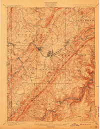
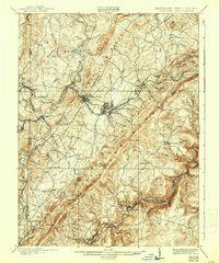
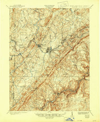
1900 Map of Oakland
USGS Topo · Published 1908About this map
Oakland serves as the focal point for this survey of Garrett County, Maryland, and neighboring West Virginia at the close of the 19th century. The Baltimore and Ohio RR dictates the development of the corridor, linking the mountain resorts of Deer Park and Mountain Lake Park to the seat of commerce. Along the Youghiogheny River and Little Youghiogheny River, small settlements like Crellin and Hutton reflect the region's industrial ties to the Preston Lumber RR and the timber-rich highlands.
Find a feature on this map
90 named features on this map. Tap any name to fly to it.
Don’t see what you’re looking for? This feature index may not catch every label — zoom into the map to look around manually.
Map Details
Editions of this 1900 Oakland Map
5 editions found

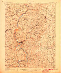
Other maps of this area

1886 · St. George
USGS Topo · 1:125,000

1891 · St. George
USGS Topo · 1:125,000

1895 · Piedmont
USGS Topo · 1:125,000

1899 · Grantsville
USGS Topo · 1:62,500

1899 · Oakland
USGS Topo · 1:62,500

1900 · Accident
USGS Topo · 1:62,500

1900 · Oakland
USGS Topo · 1:62,500

1904 · Bruceton
USGS Topo · 1:62,500

1904 · Grantsville
USGS Topo · 1:62,500
1907 · Kingwood
USGS Topo · 1:62,500