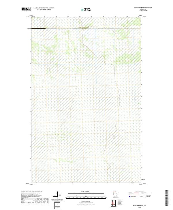
2022 Map of Oaks Corner SW
USGS Topo · Published 2022About this map
The county line between Lake of the Woods Co and Beltrami Co crosses the northern portion of this landscape, marking a jurisdictional boundary in this northern Minnesota region. This area is defined by the Public Land Survey System grids of t157n r34w, t157n r33w, t156n r34w, t156n r33w, t155n r34w, and t155n r33w, which organize the territory into a series of numbered sections. The map reveals an area largely devoid of named settlements or infrastructure, emphasizing a wilderness character typical of the borderlands. Genealogists and land researchers can use these specific township and range coordinates to pinpoint historical property locations or timber claims within the dense wetlands and woods that characterize this part of the state.
Find a feature on this map
7 named features on this map. Tap any name to fly to it.
Don’t see what you’re looking for? This feature index may not catch every label — zoom into the map to look around manually.
Map Details
Editions of this 2022 Oaks Corner SW Map
This is the sole edition of this map. No revisions or reprints were ever made.
Other maps of this area

1918 · F
USGS Topo · 1:62,500

1919 · G
USGS Topo · 1:62,500

1919 · Ponemah
USGS Topo · 1:62,500

1943 · Ponemah
USGS Topo · 1:62,500

1954 · Roseau
USGS Topo · 1:250,000

1957 · Roseau
USGS Topo · 1:250,000

1958 · Roseau
USGS Topo · 1:250,000

1973 · Manomin Creek
USGS Topo · 1:24,000
1974 · Hilman Lake
USGS Topo · 1:24,000
1974 · Shilling Dam
USGS Topo · 1:24,000