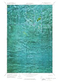
1974 Map of Oaks Corner SW
USGS Topo · Published 1976About this map
Beltrami Island State Forest dominates this orthophotomap, revealing a northern Minnesota landscape defined by extensive wetland management and timber conservation during the mid-1970s. The survey captures the intersection of the Red Lake State Wildlife Management Area and the Red Lake Ind Res, showcasing a region almost entirely devoid of traditional roads or permanent settlements. Instead, the aerial photography highlights the intricate patterns of forest boundaries and drainage, as well as the political border between Lake of the Woods Co and Beltrami Co. This document is a precise record of the peatlands and woods in the Oaks Corner SW quadrangle, where the natural terrain and state-managed wildlife habitats take precedence over human infrastructure.
Find a feature on this map
4 named features on this map. Tap any name to fly to it.
Don’t see what you’re looking for? This feature index may not catch every label — zoom into the map to look around manually.
Map Details
Editions of this 1974 Oaks Corner SW Map
This is the sole edition of this map. No revisions or reprints were ever made.
Other maps of this area

1918 · F
USGS Topo · 1:62,500

1919 · G
USGS Topo · 1:62,500

1919 · Ponemah
USGS Topo · 1:62,500

1943 · Ponemah
USGS Topo · 1:62,500

1954 · Roseau
USGS Topo · 1:250,000

1957 · Roseau
USGS Topo · 1:250,000

1958 · Roseau
USGS Topo · 1:250,000

1973 · Manomin Creek
USGS Topo · 1:24,000
1974 · Hilman Lake
USGS Topo · 1:24,000
1974 · Shilling Dam
USGS Topo · 1:24,000