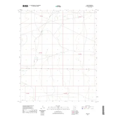
2020 Map of Oasis
USGS Topo · Published 2020About this map
Oasis serves as a central point in this Chaves County landscape, where the intersection of 2nd St and Quemado Rd defines a small footprint of habitation within a vast network of grazing lands. The distribution of water infrastructure throughout the quadrangle highlights the importance of the livestock economy in this semi-arid region. Named water sources such as Westfall Tanks, Claypit Tanks, and Crump Tanks are spaced across the township and range divisions, connected by a web of local roads including Co Rd 65 and Cato Rd. These features, alongside Meadow Tanks and Beadle Tank, represent the vital hydraulic management necessary for ranching operations in eastern New Mexico. The grid of the Public Land Survey System remains the primary organizational structure for the area, visible through the section boundaries and the straight paths of secondary routes like Inez Rd.
Find a feature on this map
22 named features on this map. Tap any name to fly to it.
Don’t see what you’re looking for? This feature index may not catch every label — zoom into the map to look around manually.
Map Details
Editions of this 2020 Oasis Map
This is the sole edition of this map. No revisions or reprints were ever made.
Other maps of this area
1949 · Sardine Mountain
USGS Topo · 1:24,000
1949 · Malstrom Ranch
USGS Topo · 1:24,000

1954 · Brownfield
USGS Topo · 1:250,000

1955 · Roswell
USGS Topo · 1:250,000

1958 · Brownfield
USGS Topo · 1:250,000

1958 · Roswell
USGS Topo · 1:250,000
1962 · Roswell
USGS Topo · 1:250,000

1962 · Brownfield
USGS Topo · 1:250,000
1967 · Sardine Lake
USGS Topo · 1:24,000
1973 · Culp Ranch
USGS Topo · 1:24,000