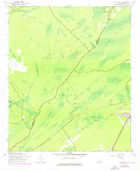
1943 Map of Ocean Bay
USGS Topo · Published 1976About this map
The Francis Marion National Forest dominates this Lowcountry landscape, where dense swamp networks and historic timber transport routes define the terrain. The presence of an Old Railroad Grade cutting through the center of the sheet reflects the era's logging infrastructure, linking the high ground of Ocean Bay to the watery basins of Wambaw Swamp. Small community focal points are scattered along the margins, including the Halfway Creek Sch and the Ocean Grove Ch near the southeastern boundary.
Find a feature on this map
25 named features on this map. Tap any name to fly to it.
Don’t see what you’re looking for? This feature index may not catch every label — zoom into the map to look around manually.
Map Details
Editions of this 1943 Ocean Bay Map
4 editions found

Other maps of this area

1919 · Wando
USGS Topo · 1:21,120

1919 · Cordesville
USGS Topo · 1:48,000

1919 · Bulls Island
USGS Topo · 1:21,120

1919 · Sewee Bay
USGS Topo · 1:21,120

1942 · Honey Hill
USGS Topo · 1:24,000

1943 · Wando
USGS Topo · 1:24,000

1943 · Sewee Bay
USGS Topo · 1:24,000

1943 · Bulls Island
USGS Topo · 1:24,000

1943 · Shulerville
USGS Topo · 1:24,000

1943 · Awendaw
USGS Topo · 1:24,000