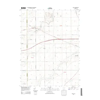
2013 Map of Oceola
USGS Topo · Published 2013About this map
Oceola and the surrounding Crawford County farmland are documented in this 2013 topographic study, revealing a landscape defined by its river systems and agricultural grid. The upper reaches of the Sandusky River and the winding course of Broken Sword Creek cut through the terrain, while the historic Lincoln Hwy serves as a primary east-west corridor alongside the more modern Us-30. Genealogists will find significant detail in the cluster of burial sites near the village, including Oceola Number 1 Cem, Oceola Number 2 Cem, and Oceola Number 3 Cem. Industrial activity is noted north of the town at Quarry Lake, while the eastern edge of the map shows the residential outskirts of Bucyrus. Other small settlements such as Spore and Nevada anchor the corners of this rural Ohio township.
Find a feature on this map
92 named features on this map. Tap any name to fly to it.
Don’t see what you’re looking for? This feature index may not catch every label — zoom into the map to look around manually.
Map Details
Editions of this 2013 Oceola Map
This is the sole edition of this map. No revisions or reprints were ever made.
Other maps of this area

1903 · Marion
USGS Topo · 1:62,500

1905 · Marion
USGS Topo · 1:62,500

1906 · Sycamore
USGS Topo · 1:62,500

1913 · Mount Gilead
USGS Topo · 1:62,500

1915 · Bucyrus
USGS Topo · 1:62,500

1916 · Mount Gilead
USGS Topo · 1:62,500

1943 · Bucyrus
USGS Topo · 1:62,500

1943 · Mount Gilead
USGS Topo · 1:62,500

1950 · Marion
USGS Topo · 1:250,000

1960 · Sycamore
USGS Topo · 1:24,000