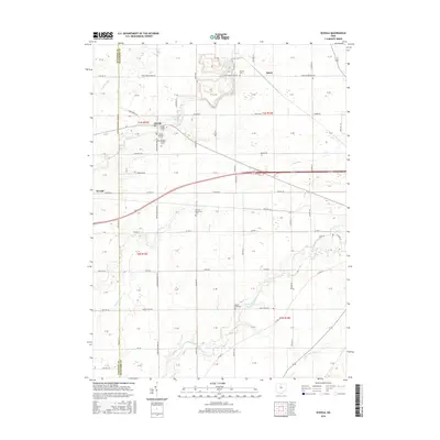
2016 Map of Oceola
USGS Topo · Published 2016About this map
Oceola and the surrounding agricultural landscape of Crawford County are defined by the winding paths of Broken Sword Creek and the Sandusky River. This 2016 survey highlights a cluster of significant local burial grounds including Oceola Number 1 Cem, Oceola Number 2 Cem, and Oceola Number 3 Cem, providing valuable spatial data for genealogists tracking families in the area. Further north, the settlement of Spore sits near Bethel Cem and the industrial footprint of Quarry Lake, while the German Reformed Cem and Mount Zion Cem mark long-established rural community centers. The geography transitions from the creek-fed lowlands to the Little Scioto River in the southeast, connected by a network of township roads such as Spore Brandywine Rd and Mount Zion Rd that maintain the traditional section-line grid of the Ohio countryside.
Find a feature on this map
78 named features on this map. Tap any name to fly to it.
Don’t see what you’re looking for? This feature index may not catch every label — zoom into the map to look around manually.
Map Details
Editions of this 2016 Oceola Map
This is the sole edition of this map. No revisions or reprints were ever made.
Other maps of this area

1903 · Marion
USGS Topo · 1:62,500

1905 · Marion
USGS Topo · 1:62,500

1906 · Sycamore
USGS Topo · 1:62,500

1913 · Mount Gilead
USGS Topo · 1:62,500

1915 · Bucyrus
USGS Topo · 1:62,500

1916 · Mount Gilead
USGS Topo · 1:62,500

1943 · Bucyrus
USGS Topo · 1:62,500

1943 · Mount Gilead
USGS Topo · 1:62,500

1950 · Marion
USGS Topo · 1:250,000

1960 · Sycamore
USGS Topo · 1:24,000