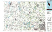
1984 Map of Oconomowoc
USGS Topo · Published 1985About this map
Horicon Marsh State Wildlife Area dominates the northern reaches of this mid-1980s survey, representing a vast glacial wetland complex that defines the regional hydrology alongside the Rock River. To the southeast, the landscape transitions from the agricultural open spaces of Dodge Co and Jefferson Co into the increasingly suburbanized corridors of Waukesha and Brookfield on the edge of the Milwaukee metropolitan area. This era shows a well-established transportation network where the Chicago and North Western and Milwaukee Road railways intersect historic settlements like Watertown and Oconomowoc. The map detail highlights the numerous kettle lakes of the Kettle Moraine State Forest and the prominent landmark of Holy Hill, illustrating the unique post-glacial topography that has influenced both the conservation of wildlife areas and the placement of early Wisconsin villages.
Find a feature on this map
73 named features on this map. Tap any name to fly to it.
Don’t see what you’re looking for? This feature index may not catch every label — zoom into the map to look around manually.
Map Details
Editions of this 1984 Oconomowoc Map
This is the sole edition of this map. No revisions or reprints were ever made.
Other maps of this area

1890 · Sun Prairie
USGS Topo · 1:62,500

1890 · Stoughton
USGS Topo · 1:62,500

1891 · Waterloo
USGS Topo · 1:62,500

1891 · Koshkonong
USGS Topo · 1:62,500

1891 · Bayview
USGS Topo · 1:62,500

1891 · Muskego
USGS Topo · 1:62,500

1892 · Milwaukee
USGS Topo · 1:62,500

1892 · Waukesha
USGS Topo · 1:62,500

1892 · Watertown
USGS Topo · 1:62,500

1892 · Oconomowoc
USGS Topo · 1:62,500