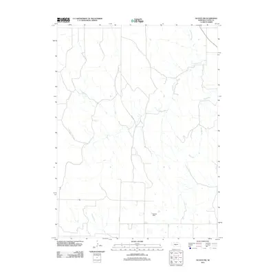
2011 Map of Oconto NW
USGS Topo · Published 2011About this map
Redfern Table rises as a prominent geographic feature in this section of Custer County, shaping the drainage patterns and road networks of the rural Nebraska landscape. The high ground of the table is framed by the branching headwaters of several key waterways, including the winding Wood River and the extensive reach of Cottonwood Creek. This 2011 survey by the U.S. Geological Survey captures a sparsely populated agricultural region defined by its topography and the section-line roads that navigate it. Cozad Rd provides a primary north-south artery through the area, following the natural contours of the land between the drainages of Cottonwood and Spring Creek. The map illustrates the specialized landscape of central Nebraska, where broad tables and deep-cut creek beds dictate the placement of ranching infrastructure and local transit routes.
Find a feature on this map
5 named features on this map. Tap any name to fly to it.
Don’t see what you’re looking for? This feature index may not catch every label — zoom into the map to look around manually.
Map Details
Editions of this 2011 Oconto NW Map
This is the sole edition of this map. No revisions or reprints were ever made.
Other maps of this area

1951 · Callaway SE
USGS Topo · 1:24,000

1951 · Callaway
USGS Topo · 1:24,000

1951 · Oconto SW
USGS Topo · 1:24,000

1951 · Oconto SE
USGS Topo · 1:24,000

1951 · Oconto NW
USGS Topo · 1:24,000

1951 · Oconto
USGS Topo · 1:24,000

1954 · North Platte
USGS Topo · 1:250,000

1955 · Broken Bow
USGS Topo · 1:250,000

1956 · Broken Bow
USGS Topo · 1:250,000

1956 · North Platte
USGS Topo · 1:250,000