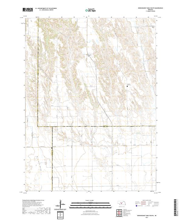
2021 Map of Odencranze Table South
USGS Topo · Published 2021About this map
The high plains of Nebraska converge where the borders of Custer, Lincoln, and Dawson counties meet. This agricultural landscape is defined by elevated landforms such as Odencranze Table and Rock Island Table, which overlook drainage systems like the Cottonwood Valley and Wild Horse Valley. The presence of the Swedish Grove Cem and Linburg Cem suggests a history of rural community life centered around these high mesas. Water management is critical in this environment, evidenced by the Franzen Reservoir and the winding path of Buffalo Cr. The layout of the region follows a strict section-line grid of roads, including Svea Dal Rd and S Svedel Rd, reflecting the Scandinavian heritage of the early homesteaders who settled this portion of the Nebraska tablelands.
Find a feature on this map
35 named features on this map. Tap any name to fly to it.
Don’t see what you’re looking for? This feature index may not catch every label — zoom into the map to look around manually.
Map Details
Editions of this 2021 Odencranze Table South Map
This is the sole edition of this map. No revisions or reprints were ever made.
Other maps of this area

1902 · Gothenburg
USGS Topo · 1:125,000

1954 · McCook
USGS Topo · 1:250,000

1954 · North Platte
USGS Topo · 1:250,000

1956 · North Platte
USGS Topo · 1:250,000

1957 · North Platte
USGS Topo · 1:250,000

1957 · McCook
USGS Topo · 1:250,000

1958 · McCook
USGS Topo · 1:250,000

1967 · North Platte
USGS Topo · 1:250,000
1970 · Gothenburg
USGS Topo · 1:24,000
1970 · Willow Island
USGS Topo · 1:24,000