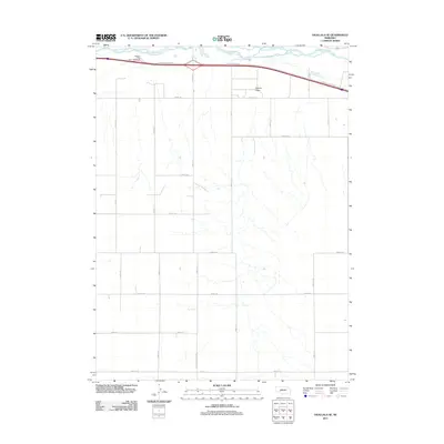
2011 Map of Ogallala SE
USGS Topo · Published 2011About this map
The South Platte River winds through the northern portion of this Keith County landscape, carving a wide valley that dictated the path of modern infrastructure. This 2011 survey reveals how the ancient river corridor continues to shape the region, with the W Roscoe Service Rd and Roscoe Service Rd paralleling the water's edge. South of the river, the terrain rises into the distinctive Roscoe Draw, where the land is carved by a network of drainage patterns that cut across the agricultural grid. The map displays a highly organized section-line road system, including the curiously named Road E High School, which suggests the historical or planned location of local educational facilities. Travelers along the interstate are noted at the Ogallala Rest Area - Westbound, a modern landmark in a landscape defined by its riparian history and organized rural development.
Find a feature on this map
20 named features on this map. Tap any name to fly to it.
Don’t see what you’re looking for? This feature index may not catch every label — zoom into the map to look around manually.
Map Details
Editions of this 2011 Ogallala SE Map
This is the sole edition of this map. No revisions or reprints were ever made.
Other maps of this area

1897 · Ogallala
USGS Topo · 1:125,000

1898 · Paxton
USGS Topo · 1:125,000

1900 · Ogallala
USGS Topo · 1:125,000

1901 · Paxton
USGS Topo · 1:125,000

1954 · McCook
USGS Topo · 1:250,000

1954 · North Platte
USGS Topo · 1:250,000

1956 · North Platte
USGS Topo · 1:250,000

1957 · North Platte
USGS Topo · 1:250,000

1957 · McCook
USGS Topo · 1:250,000

1958 · McCook
USGS Topo · 1:250,000