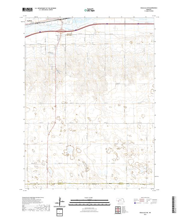
2021 Map of Ogallala SW
USGS Topo · Published 2021About this map
The South Platte River cuts across the northern edge of this landscape, just south of Ogallala, where modern infrastructure meets historic pathways. The terrain to the south transitions into the undulating draws of Happy Hollow, a drainage system that defines the local topography. This area preserves the memory of westward expansion through local road names like Stagecoach Trl and Oregon Trail Dr, which run parallel to the river valley.
Find a feature on this map
40 named features on this map. Tap any name to fly to it.
Don’t see what you’re looking for? This feature index may not catch every label — zoom into the map to look around manually.
Map Details
Editions of this 2021 Ogallala SW Map
This is the sole edition of this map. No revisions or reprints were ever made.
Other maps of this area

1897 · Ogallala
USGS Topo · 1:125,000

1900 · Ogallala
USGS Topo · 1:125,000

1954 · McCook
USGS Topo · 1:250,000

1954 · North Platte
USGS Topo · 1:250,000

1956 · North Platte
USGS Topo · 1:250,000

1957 · North Platte
USGS Topo · 1:250,000

1957 · McCook
USGS Topo · 1:250,000

1958 · McCook
USGS Topo · 1:250,000

1961 · Brandon NE
USGS Topo · 1:24,000
1961 · Brule SE
USGS Topo · 1:24,000