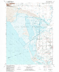
1991 Map of Ogden Bay
USGS Topo · Published 1991About this map
Ogden Bay and the eastern fringes of the Great Salt Lake dominate this 1991 revision, illustrating a landscape where the Weber River delta fans out into complex wetlands. The map details the managed marshes of the Ogden Bay State Waterfowl Management Area and the Howard Slough State Waterfowl Management Area, crisscrossed by the North Fork Weber River and Middle Fork Weber River.
Find a feature on this map
39 named features on this map. Tap any name to fly to it.
Don’t see what you’re looking for? This feature index may not catch every label — zoom into the map to look around manually.
Map Details
Editions of this 1991 Ogden Bay Map
This is the sole edition of this map. No revisions or reprints were ever made.
Other maps of this area

1954 · Antelope Island North
USGS Topo · 1:24,000

1954 · Brigham City
USGS Topo · 1:250,000

1955 · Plain City
USGS Topo · 1:24,000

1955 · Clearfield
USGS Topo · 1:24,000

1955 · Roy
USGS Topo · 1:24,000

1955 · Willard Spur
USGS Topo · 1:24,000

1955 · Plain City SW
USGS Topo · 1:24,000

1955 · Ogden Bay
USGS Topo · 1:24,000

1955 · Fremont Island
USGS Topo · 1:24,000

1958 · Brigham City
USGS Topo · 1:250,000