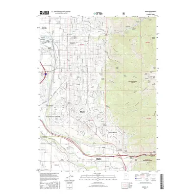
2017 Map of Ogden
USGS Topo · Published 2017About this map
Ogden and its surrounding communities sit at the foot of the Wasatch Range, where the steep eastern peaks descend into a complex urban and industrial corridor. The Ogden River and Weber River converge in the western lowlands near West Ogden and Marriott-Slaterville, defining the early hydrology of the region. Transportation and defense infrastructure dominate the southern landscape, anchored by the expansive grounds of Hill Air Force Base and the Ogden-Hinckley Airport. The city's growth is evident in the residential spread of South Ogden and Uintah Highlands, pushing right to the boundary of the Cache National Forest. In the rugged eastern terrain, high-altitude features like Mt Ogden and Malans Peak tower over local canyons, while the Union Pacific railroad line maintains its critical path through Weber Canyon toward Uintah Junction.
Find a feature on this map
123 named features on this map. Tap any name to fly to it.
Don’t see what you’re looking for? This feature index may not catch every label — zoom into the map to look around manually.
Map Details
Editions of this 2017 Ogden Map
This is the sole edition of this map. No revisions or reprints were ever made.
Other maps of this area

1954 · Ogden
USGS Topo · 1:250,000

1954 · Brigham City
USGS Topo · 1:250,000

1955 · Ogden
USGS Topo · 1:24,000

1955 · Plain City
USGS Topo · 1:24,000

1955 · Clearfield
USGS Topo · 1:24,000

1955 · Roy
USGS Topo · 1:24,000

1955 · Peterson
USGS Topo · 1:24,000

1955 · Huntsville
USGS Topo · 1:24,000

1955 · North Ogden
USGS Topo · 1:24,000

1955 · Kaysville
USGS Topo · 1:24,000