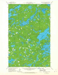
1959 Map of Ogishkemuncie Lake
USGS Topo · Published 1967About this map
Ogishkemuncie Lake serves as the central focal point of this 1959 survey, revealing a landscape defined by an intricate network of waterways at the boundary of Lake and Cook Counties. This northern wilderness, positioned within the Superior National Forest and the Minnesota State Forest, showcases a post-glacial terrain where water bodies like Gabimichigami Lake and the South Arm dominate the geography. The map illustrates a primitive environment where named features such as Eddy Lake, Boulder Lake, and Elton Lake are connected only by a series of trails, indicating an area largely untouched by modern road infrastructure during the mid-century. Researchers will note the density of smaller, curiously named basins such as Cookoosh Lake, Hoe Lake, and Incus Lake, which highlight the complex topography of the Iron Range region before further development or management changes occurred.
Find a feature on this map
86 named features on this map. Tap any name to fly to it.
Don’t see what you’re looking for? This feature index may not catch every label — zoom into the map to look around manually.
Map Details
Editions of this 1959 Ogishkemuncie Lake Map
4 editions found
Other maps of this area

1954 · Two Harbors
USGS Topo · 1:250,000

1957 · Two Harbors
USGS Topo · 1:250,000

1957 · Quetico
USGS Topo · 1:250,000

1958 · Two Harbors
USGS Topo · 1:250,000

1959 · Munker Island
USGS Topo · 1:24,000

1959 · Ogishkemuncie Lake
USGS Topo · 1:24,000

1959 · Kekekabic Lake
USGS Topo · 1:24,000

1959 · Dutton Lake
USGS Topo · 1:24,000

1959 · Gillis Lake
USGS Topo · 1:24,000

1959 · Ester Lake
USGS Topo · 1:24,000