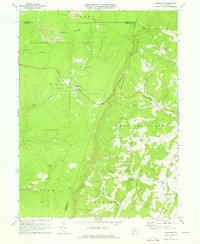
1971 Map of Ogletown
USGS Topo · Published 1976About this map
Babcock State Forest dominates the high-elevation terrain of the Allegheny Front in this 1970s topographic study, where the borders of Somerset, Cambria, and Bedford Counties converge. The landscape is defined by deep drainages like Calvary Hollow and Coon Hol, with small settlements such as Ogletown and Ryot situated along the winding mountain roads. Resource extraction is evident near Pot Ridge, where a Strip Mine and multiple pipelines cut across the wooded ridges, illustrating the industrial pressures on the rural landscape during this era.
Find a feature on this map
33 named features on this map. Tap any name to fly to it.
Don’t see what you’re looking for? This feature index may not catch every label — zoom into the map to look around manually.
Map Details
Editions of this 1971 Ogletown Map
4 editions found
Other maps of this area

1902 · Ebensburg
USGS Topo · 1:62,500

1904 · Ebensburg
USGS Topo · 1:62,500

1904 · Johnstown
USGS Topo · 1:62,500

1907 · Johnstown
USGS Topo · 1:62,500

1908 · Bedford
USGS Topo · 1:62,500

1910 · Bedford
USGS Topo · 1:62,500

1914 · Windber
USGS Topo · 1:62,500

1916 · Windber
USGS Topo · 1:62,500

1944 · Windber
USGS Topo · 1:62,500

1953 · Pittsburgh
USGS Topo · 1:250,000