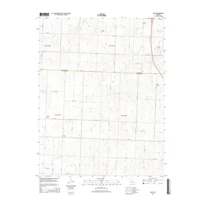
2014 Map of Ohio
USGS Topo · Published 2014About this map
Ohio sits within a landscape defined by the drainage basins of the Harry S Truman Reservoir and its numerous tributaries in this 2014 rural Missouri study. The terrain is deeply carved by water, with Cooper Creek, Little Monegan Cr, and Spill Cr creating a complex network of ridges and hollows across the Henry Co St. Clair Co border. This area is characterized by a sparse settlement pattern of scattered farmsteads connected by a precise grid of rural roads such as NW 1000 Rd and SW 1100 Rd.
Find a feature on this map
53 named features on this map. Tap any name to fly to it.
Don’t see what you’re looking for? This feature index may not catch every label — zoom into the map to look around manually.
Map Details
Editions of this 2014 Ohio Map
This is the sole edition of this map. No revisions or reprints were ever made.
Other maps of this area

1887 · Clinton
USGS Topo · 1:125,000

1894 · Clinton
USGS Topo · 1:125,000

1938 · Monegaw Springs
USGS Topo · 1:24,000

1938 · Taberville
USGS Topo · 1:24,000

1939 · Osceola
USGS Topo · 1:24,000

1940 · Taberville
USGS Topo · 1:24,000

1940 · Osceola
USGS Topo · 1:24,000
1940 · Monegaw Springs
USGS Topo · 1:24,000

1941 · Lowry City
USGS Topo · 1:24,000

1945 · Lowry City
USGS Topo · 1:24,000