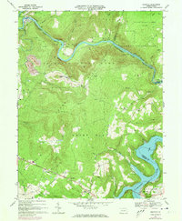
1967 Map of Ohiopyle
USGS Topo · Published 1973About this map
The Youghiogheny River carves a deep path through the heart of Ohiopyle State Park, anchoring a landscape of sharp relief and narrow valleys. This mid-century view shows the winding corridor of the Baltimore and Ohio Maryland and Western railroad as it hugs the riverbanks, connecting small outposts like Bidwell Sta and Victoria. Further south, the National Road traverses the high ground near Woodcock Hill, providing a contrast to the rail-driven economy of the river canyon.
Find a feature on this map
57 named features on this map. Tap any name to fly to it.
Don’t see what you’re looking for? This feature index may not catch every label — zoom into the map to look around manually.
Map Details
Editions of this 1967 Ohiopyle Map
3 editions found
Other maps of this area

1900 · Accident
USGS Topo · 1:62,500

1900 · Uniontown
USGS Topo · 1:62,500

1904 · Bruceton
USGS Topo · 1:62,500

1922 · Confluence
USGS Topo · 1:62,500

1926 · Bruceton
USGS Topo · 1:62,500

1931 · Uniontown
USGS Topo · 1:62,500

1931 · Confluence
USGS Topo · 1:62,500

1931 · Bruceton Mills
USGS Topo · 1:62,500

1933 · Confluence
USGS Topo · 1:62,500

1933 · Bruceton
USGS Topo · 1:62,500
Featured Places
- Ohiopyle, PA
- Addison Township, PA
- Lower Turkeyfoot Township, PA
- Wharton Township, PA
- Stewart Township, PA