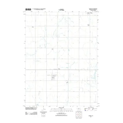
2011 Map of Ohiowa
USGS Topo · Published 2011About this map
Ohiowa and Milligan anchor this portion of Fillmore County, reflecting the deep-rooted agricultural and cultural heritage of the Nebraska plains. The landscape is structured by a precise section-line road grid, including Road O and Road 24, which circumnavigates the drainages of South Fork Turkey Creek, Little Sandy Creek, and Walnut Creek. Genealogy researchers will find significant value in the distribution of local burial grounds, such as the Bohemian National Cemetery, which speaks to the specific immigrant history of the region, alongside the Chelsea Cemetery, Pioneer Cemetery, and the denominational distinction between the North Lutheran Cemetery and South Lutheran Cemetery. These sites, along with the Ohiowa Post Office and Milligan Post Office, mark the civic heart of these rural communities as they appeared in the early 21st century. The presence of the Sieber Reservoir in the southwest corner illustrates local water management within this well-ordered prairie terrain.
Find a feature on this map
31 named features on this map. Tap any name to fly to it.
Don’t see what you’re looking for? This feature index may not catch every label — zoom into the map to look around manually.
Map Details
Editions of this 2011 Ohiowa Map
This is the sole edition of this map. No revisions or reprints were ever made.
Other maps of this area

1898 · York
USGS Topo · 1:125,000

1898 · Hebron
USGS Topo · 1:125,000

1899 · York
USGS Topo · 1:125,000

1955 · Lincoln
USGS Topo · 1:250,000

1957 · Lincoln
USGS Topo · 1:250,000

1958 · Lincoln
USGS Topo · 1:250,000

1960 · Bruning
USGS Topo · 1:24,000

1960 · Tobias SW
USGS Topo · 1:24,000

1960 · Daykin
USGS Topo · 1:24,000

1961 · Tobias
USGS Topo · 1:24,000