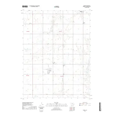
2017 Map of Ohiowa
USGS Topo · Published 2017About this map
Ohiowa sits at the center of this Fillmore County landscape, defined by the grid-patterned sections of the Nebraska plains. The village layout is closely tied to its transit origins, with S Railway St and N Railway St framing the central corridor. This 2017 survey documents the enduring presence of early pioneer and ethnic heritage through its numerous burial grounds, including the Bohemian National Cem near Milligan and the Chelsea Cem. The drainage patterns of S Fork Turkey Cr and Little Sandy Cr break the geometric regularity of the farmland, leading toward the Sieber Reservoir in the southwest. Local history is anchored by spiritual and community landmarks such as the North Lutheran Cem and South Lutheran Cem, which reflect the settlement patterns of the surrounding townships.
Find a feature on this map
27 named features on this map. Tap any name to fly to it.
Don’t see what you’re looking for? This feature index may not catch every label — zoom into the map to look around manually.
Map Details
Editions of this 2017 Ohiowa Map
This is the sole edition of this map. No revisions or reprints were ever made.
Other maps of this area

1898 · York
USGS Topo · 1:125,000

1898 · Hebron
USGS Topo · 1:125,000

1899 · York
USGS Topo · 1:125,000

1955 · Lincoln
USGS Topo · 1:250,000

1957 · Lincoln
USGS Topo · 1:250,000

1958 · Lincoln
USGS Topo · 1:250,000

1960 · Bruning
USGS Topo · 1:24,000

1960 · Tobias SW
USGS Topo · 1:24,000

1960 · Daykin
USGS Topo · 1:24,000

1961 · Tobias
USGS Topo · 1:24,000