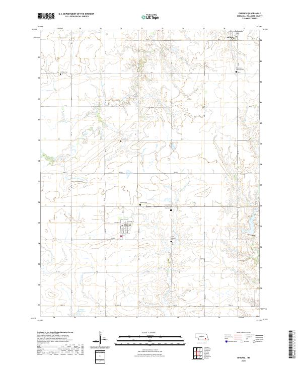
2021 Map of Ohiowa
USGS Topo · Published 2021About this map
The village of Ohiowa and its surrounding agricultural grid define this corner of Fillmore County. This modern survey illustrates a landscape of high prairie drained by the Little Sandy Cr, S Fork Turkey Cr, and Walnut Cr. The town's layout remains anchored by its core streets, including S Main St and N Railway St, while the surrounding sections are dotted with numerous historic burial grounds that serve as a testament to the area's diverse pioneer heritage. Researchers will find a concentrated cluster of these sites, ranging from the Ohiowa Cem and Saint Johns Lutheran Church Cem North to the Bohemian National Cem and Chelsea Cem. Farther south, the Sieber Reservoir provides a notable water feature amid the sprawling section lines and rural road network that characterizes this region of Nebraska.
Find a feature on this map
30 named features on this map. Tap any name to fly to it.
Don’t see what you’re looking for? This feature index may not catch every label — zoom into the map to look around manually.
Map Details
Editions of this 2021 Ohiowa Map
This is the sole edition of this map. No revisions or reprints were ever made.
Other maps of this area

1898 · York
USGS Topo · 1:125,000

1898 · Hebron
USGS Topo · 1:125,000

1899 · York
USGS Topo · 1:125,000

1955 · Lincoln
USGS Topo · 1:250,000

1957 · Lincoln
USGS Topo · 1:250,000

1958 · Lincoln
USGS Topo · 1:250,000

1960 · Bruning
USGS Topo · 1:24,000

1960 · Tobias SW
USGS Topo · 1:24,000

1960 · Daykin
USGS Topo · 1:24,000

1961 · Tobias
USGS Topo · 1:24,000