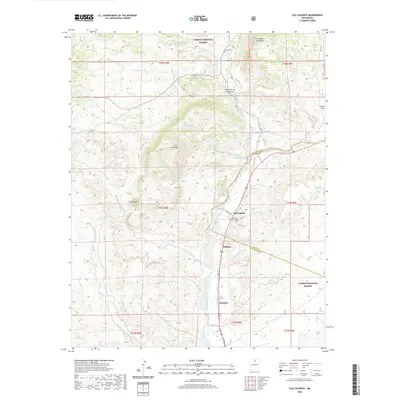
2020 Map of Ojo Caliente
USGS Topo · Published 2020About this map
The Rio Ojo Caliente valley serves as the central corridor for this 2020 survey, where the historic settlement of Ojo Caliente is anchored by its famed Mineral Springs and Iron Spring. The map documents a landscape defined by the intersection of the Carson National Forest and high desert terrain, including the La Madera Mountains and Cerro Negro. Genealogists and local historians can locate specific community sites such as the Ojo Caliente Cem and the more northern La Cueva Cem near the Cañada de la Cueva. The irrigation and drainage patterns of the region are clearly marked through numerous arroyos and cañadas, such as Arroyo Rancho and Cañada Ancha, which historically dictated the placement of small clusters of habitation like Gallegos, Duranes, and Cañoncito de la Madera. This contemporary topographic record preserves the place names and land boundaries that have shaped the Rio Arriba and Taos county line for generations.
Find a feature on this map
39 named features on this map. Tap any name to fly to it.
Don’t see what you’re looking for? This feature index may not catch every label — zoom into the map to look around manually.
Map Details
Editions of this 2020 Ojo Caliente Map
This is the sole edition of this map. No revisions or reprints were ever made.
Other maps of this area

1918 · Abiquiu
USGS Topo · 1:125,000

1953 · Medanales
USGS Topo · 1:24,000

1953 · Valle Grande Peak
USGS Topo · 1:24,000

1953 · Lyden
USGS Topo · 1:24,000

1953 · Velarde
USGS Topo · 1:24,000

1953 · El Rito
USGS Topo · 1:24,000

1953 · La Madera
USGS Topo · 1:24,000

1953 · Ojo Caliente
USGS Topo · 1:24,000

1953 · San Juan Pueblo
USGS Topo · 1:62,500

1954 · Raton
USGS Topo · 1:250,000