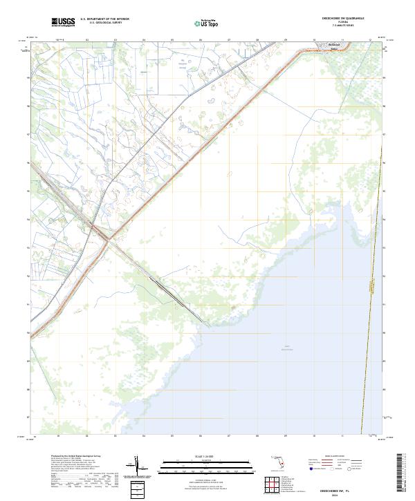
2024 Map of Okeechobee SW
USGS Topo · Published 2024About this map
Lake Okeechobee dominates the southern landscape of this Florida region, where the vast open waters meet the marshy shoreline of Glades and Okeechobee counties. The settlement at Buckhead Ridge serves as a focal point for the community, situated where the northern shore transitions into the expansive wetlands of Big Sawgrass Swamp. The map details a sophisticated network of water management and recreation, specifically the Indian Prairie Canal and the Florida National Scenic Trl, which skirts the edge of the swamp and the lake. This 2024 data highlights the modern relationship between residential development and the preserved natural environment of the Florida interior, showing how infrastructure has been integrated into the reclaimed lands north of the great lake.
Find a feature on this map
7 named features on this map. Tap any name to fly to it.
Don’t see what you’re looking for? This feature index may not catch every label — zoom into the map to look around manually.
Map Details
Editions of this 2024 Okeechobee SW Map
This is the sole edition of this map. No revisions or reprints were ever made.
Other maps of this area

1952 · Okeechobee NW
USGS Topo · 1:24,000

1952 · Okeechobee
USGS Topo · 1:24,000

1953 · Brighton
USGS Topo · 1:24,000

1953 · Brighton SE
USGS Topo · 1:24,000

1953 · Okeechobee SW
USGS Topo · 1:24,000

1956 · West Palm Beach
USGS Topo · 1:250,000

1956 · Fort Pierce
USGS Topo · 1:250,000

1957 · West Palm Beach
USGS Topo · 1:250,000

1958 · Fort Pierce
USGS Topo · 1:250,000

1958 · West Palm Beach
USGS Topo · 1:250,000