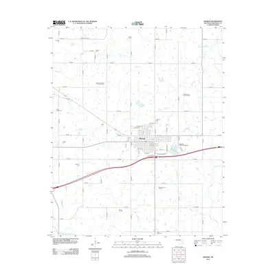
2012 Map of Okemah
USGS Topo · Published 2012About this map
Okemah serves as the central hub of this Oklahoma landscape, which is defined by a dense network of petroleum extraction sites and numerous family and community burial grounds. The territory surrounding the town is heavily marked by the energy industry, with significant operations at the Okemah Oil Field, Midwest Oil and Gas Field, and East Castle Oil Field. The grid of the town site is bounded by the Okemah Flying Field Airport to the east and the modern corridor of Interstate 40 to the south, while the N Canadian River winds through the southern reaches of the quadrangle. Genealogists will find a high density of small cemeteries scattered across the rural sections, including Highland Cem, Prairie Springs Cem, and the Wind Family Cem, reflecting the area's deep-rooted settlement history. Numerous creeks like Nuyaka Cr and Yhola Cr provide the primary drainage for these oil-rich lands.
Find a feature on this map
41 named features on this map. Tap any name to fly to it.
Don’t see what you’re looking for? This feature index may not catch every label — zoom into the map to look around manually.
Map Details
Editions of this 2012 Okemah Map
This is the sole edition of this map. No revisions or reprints were ever made.
Other maps of this area

1900 · Wewoka
USGS Topo · 1:125,000

1901 · Nuyaka
USGS Topo · 1:125,000

1954 · Oklahoma City
USGS Topo · 1:250,000

1957 · Oklahoma City
USGS Topo · 1:250,000

1963 · Oklahoma City
USGS Topo · 1:250,000

1967 · Cromwell
USGS Topo · 1:24,000

1967 · Okemah SE
USGS Topo · 1:24,000

1967 · Weleetka
USGS Topo · 1:24,000

1967 · Okemah
USGS Topo · 1:24,000

1967 · Boley
USGS Topo · 1:24,000