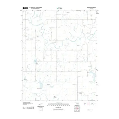
2009 Map of Okemah SE
USGS Topo · Published 2009About this map
The North Canadian River meanders through this section of Okfuskee County, defining a landscape shaped by both natural hydrology and intensive energy extraction. The region is heavily marked by its carbon history, with expansive operations such as the Bearden Oil and Gas Field, Papoose Oil Field, and East Bearden Oil Field dotting the terrain. These industrial features sit alongside a network of rural roads, including E 1140 Rd and N 3730 Rd, which connect long-standing community landmarks.
Find a feature on this map
41 named features on this map. Tap any name to fly to it.
Don’t see what you’re looking for? This feature index may not catch every label — zoom into the map to look around manually.
Map Details
Editions of this 2009 Okemah SE Map
This is the sole edition of this map. No revisions or reprints were ever made.
Other maps of this area

1900 · Wewoka
USGS Topo · 1:125,000

1954 · Oklahoma City
USGS Topo · 1:250,000

1957 · Oklahoma City
USGS Topo · 1:250,000

1963 · Oklahoma City
USGS Topo · 1:250,000

1967 · Cromwell
USGS Topo · 1:24,000

1967 · Okemah SE
USGS Topo · 1:24,000

1967 · Weleetka
USGS Topo · 1:24,000

1967 · Okemah
USGS Topo · 1:24,000

1967 · Boley
USGS Topo · 1:24,000
1967 · Clearview
USGS Topo · 1:24,000