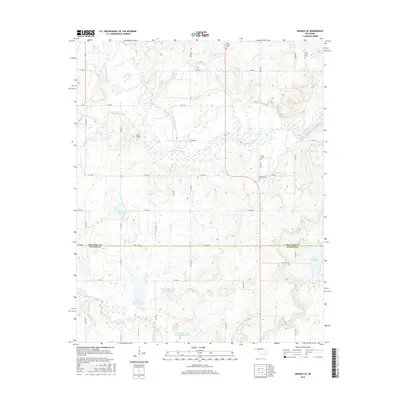
2016 Map of Okemah SE
USGS Topo · Published 2016About this map
The North Canadian River winds through a landscape of creek valleys and upland plateaus along the boundary between Okfuskee County and Hughes County. This rural Oklahoma region is defined by its water management and cemetery locations, which serve as primary landmarks for local heritage. The southern portion of the map is dominated by the upper reaches of Little Wewoka Creek, featuring several specialized water control structures like the Little Wewoka Creek Site 8 Reservoir and Little Wewoka Creek Site 10 Reservoir.
Find a feature on this map
38 named features on this map. Tap any name to fly to it.
Don’t see what you’re looking for? This feature index may not catch every label — zoom into the map to look around manually.
Map Details
Editions of this 2016 Okemah SE Map
This is the sole edition of this map. No revisions or reprints were ever made.
Other maps of this area
1900 · Wewoka
USGS Topo · 1:125,000
1954 · Oklahoma City
USGS Topo · 1:250,000
1957 · Oklahoma City
USGS Topo · 1:250,000
1963 · Oklahoma City
USGS Topo · 1:250,000
1967 · Cromwell
USGS Topo · 1:24,000
1967 · Okemah SE
USGS Topo · 1:24,000
1967 · Weleetka
USGS Topo · 1:24,000
1967 · Okemah
USGS Topo · 1:24,000
1967 · Boley
USGS Topo · 1:24,000
1967 · Clearview
USGS Topo · 1:24,000