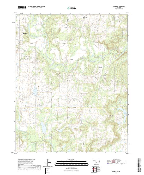
2022 Map of Okemah SE
USGS Topo · Published 2022About this map
The North Canadian River meanders across this rural landscape at the border of Okfuskee and Hughes counties. The small community of Bearden serves as a primary settlement point in the northwest, situated near the river's path. This map provides significant value for genealogical research, documenting several local burial sites including Thlopthlocco Cem, Shiloh Cem, and Saint Paul's Cem. The southern portion of the quadrangle is defined by the headwaters of Little Wewoka Cr and the northeastern reach of Lake Wetumka. The terrain is characterized by a dense network of section-line roads, such as e1180 RD and E 120 RD, which grid the area's agricultural and ranching lands, illustrating the persistent land-use patterns of central Oklahoma.
Find a feature on this map
27 named features on this map. Tap any name to fly to it.
Don’t see what you’re looking for? This feature index may not catch every label — zoom into the map to look around manually.
Map Details
Editions of this 2022 Okemah SE Map
This is the sole edition of this map. No revisions or reprints were ever made.
Other maps of this area

1900 · Wewoka
USGS Topo · 1:125,000

1954 · Oklahoma City
USGS Topo · 1:250,000

1957 · Oklahoma City
USGS Topo · 1:250,000

1963 · Oklahoma City
USGS Topo · 1:250,000

1967 · Cromwell
USGS Topo · 1:24,000

1967 · Okemah SE
USGS Topo · 1:24,000

1967 · Weleetka
USGS Topo · 1:24,000

1967 · Okemah
USGS Topo · 1:24,000

1967 · Boley
USGS Topo · 1:24,000
1967 · Clearview
USGS Topo · 1:24,000