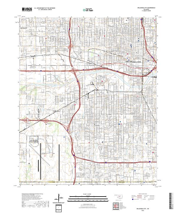
2022 Map of Oklahoma City
USGS Topo · Published 2022About this map
The North Canadian River flows through the heart of the state capital, anchoring a landscape where civic institutions and industrial infrastructure meet. This 2022 survey details the dense urban core of Oklahoma City, extending west to the city of Bethany. High-value genealogy landmarks are prominent, including the Fairlawn Cem, the Hebrew Cem, and the Czechoslovakian National Cem, alongside institutional centers like Oklahoma City University and the University of Oklahoma Health Sciences Center. The map traces the sprawling footprint of the Will Rogers World Airport in the southwest, contrasting with the tightly gridded residential blocks and government seats such as the Oklahoma State Supreme Court and Oklahoma County Courthouse. Major drainage patterns are defined by Deep Fork and Twin Cr, illustrating how the modern metropolitan area has integrated its natural watercourses into a complex network of boulevards and interstate corridors.
Find a feature on this map
194 named features on this map. Tap any name to fly to it.
Don’t see what you’re looking for? This feature index may not catch every label — zoom into the map to look around manually.
Map Details
Editions of this 2022 Oklahoma City Map
This is the sole edition of this map. No revisions or reprints were ever made.
Other maps of this area

1892 · Moore
USGS Topo · 1:62,500

1892 · Edmond
USGS Topo · 1:62,500

1892 · Kingfisher
USGS Topo · 1:125,000

1893 · Oklahoma City
USGS Topo · 1:62,500

1895 · Kingfisher
USGS Topo · 1:125,000

1898 · Purcell
USGS Topo · 1:125,000

1904 · Chickasha
USGS Topo · 1:125,000

1934 · Crutcho Creek
USGS Topo · 1:24,000

1934 · Moore
USGS Topo · 1:62,500

1935 · Spencer
USGS Topo · 1:24,000