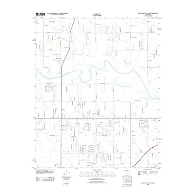
2012 Map of Oklahoma City SW
USGS Topo · Published 2012About this map
The Canadian River winds through this landscape southwest of the metropolitan center, defining a corridor of variable terrain marked by Bartons Butte. By the early twenty-first century, the area shows a transition from structured residential developments to larger rural tracts, particularly north of the river. Aviation history is represented by the presence of Low Pass Airport and the Cole Landing Area Airport, small airfields that reflect the region's long-standing connection to private flight. A dense network of residential streets and arterial roads like S Mustang Rd and S Council Rd crisscross the land, while several smaller waterways including Coal Cr, Cow Cr, and Worley Cr drain the watershed into the main river channel. This survey documents the intersection of suburban growth and the traditional Oklahoma plains landscape.
Find a feature on this map
156 named features on this map. Tap any name to fly to it.
Don’t see what you’re looking for? This feature index may not catch every label — zoom into the map to look around manually.
Map Details
Editions of this 2012 Oklahoma City SW Map
This is the sole edition of this map. No revisions or reprints were ever made.
Other maps of this area

1893 · Oklahoma City
USGS Topo · 1:62,500

1893 · Minco
USGS Topo · 1:62,500

1904 · Chickasha
USGS Topo · 1:125,000

1954 · Oklahoma City
USGS Topo · 1:250,000

1956 · Oklahoma City
USGS Topo · 1:24,000

1956 · Oklahoma City
USGS Topo · 1:62,500

1956 · Oklahoma City SE
USGS Topo · 1:24,000

1957 · Oklahoma City
USGS Topo · 1:250,000

1963 · Oklahoma City
USGS Topo · 1:250,000
1965 · Newcastle
USGS Topo · 1:24,000