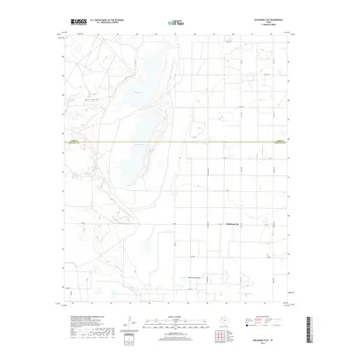
2019 Map of Oklahoma Flat
USGS Topo · Published 2019About this map
Yellow Lake and Illusion Lake dominate the central topography of this Llano Estacado landscape, marking a distinctive north-south drainage corridor through the High Plains. The settlement of Oklahoma Flat serves as a focal point for a vast network of local roads that bear names suggesting a diverse history of migration or surveying, including Poland, Ontario, Lansing, and Spain. The geography is defined by broad depressions and intermittent water features, such as Goat Draw and its associated Upper Goat Tank, which illustrate the region's reliance on localized water catchments. Straddling the boundary between Lamb and Hockley counties, the map reveals a highly structured grid of farm-to-market roads like FM 597 and FM 1490, alongside more informally named tracks such as Yukon and Usa RD, reflecting the intersection of industrial agriculture and local homesteading.
Find a feature on this map
24 named features on this map. Tap any name to fly to it.
Don’t see what you’re looking for? This feature index may not catch every label — zoom into the map to look around manually.
Map Details
Editions of this 2019 Oklahoma Flat Map
This is the sole edition of this map. No revisions or reprints were ever made.
Other maps of this area

1954 · Brownfield
USGS Topo · 1:250,000

1958 · Brownfield
USGS Topo · 1:250,000

1962 · Brownfield
USGS Topo · 1:250,000
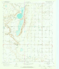
1964 · Oklahoma Flat
USGS Topo · 1:24,000
1964 · Littlefield
USGS Topo · 1:24,000
1964 · Bull Lake
USGS Topo · 1:24,000
1964 · Pep
USGS Topo · 1:24,000
1964 · Lums Chapel
USGS Topo · 1:24,000
1964 · Beck
USGS Topo · 1:24,000
1964 · Whitharral
USGS Topo · 1:24,000