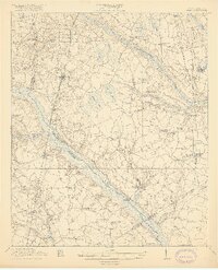
1919 Map of Olar
USGS Topo · Published 1919About this map
The Salkehatchie River and its companion, the Little Salkehatchie River, define the landscape of this Lowcountry region at the close of the First World War. This 1918 survey illustrates a rural economy organized around the Seaboard Line and Atlantic Coast Line railroads, which facilitated the movement of goods from settlements like Olar and Ehrhardt. The mapping of Numerous 'bays' and 'swamps', such as Horsepen Bay and Bruston Swamp, indicates the hydraulic character of the terrain, where river crossings like Buford Bridge and Rivers Bridge served as vital connective nodes.
Find a feature on this map
65 named features on this map. Tap any name to fly to it.
Don’t see what you’re looking for? This feature index may not catch every label — zoom into the map to look around manually.
Map Details
Editions of this 1919 Olar Map
3 editions found
Other maps of this area

1918 · Varnville
USGS Topo · 1:62,500

1919 · Olar
USGS Topo · 1:62,500

1919 · Bamberg
USGS Topo · 1:48,000

1919 · Allendale
USGS Topo · 1:62,500

1919 · Cummings
USGS Topo · 1:62,500

1919 · Lodge
USGS Topo · 1:62,500

1920 · Lodge
USGS Topo · 1:48,000

1920 · Bamberg
USGS Topo · 1:62,500

1920 · Peeples
USGS Topo · 1:62,500

1920 · Orangeburg
USGS Topo · 1:48,000