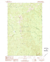
1989 Map of Old Baldy
USGS Topo · Published 1989About this map
Okanogan National Forest covers this high-elevation landscape, where the peaks of Old Baldy and Starvation Mtn command the horizon. The 1989 topography reveals a rugged drainage network defined by the West Fork Salmon Creek and the headwaters of Granite Creek. A primary point of human transit through this terrain is the Golden Stairway Trail, which navigates the steep grades between ridges.
Find a feature on this map
31 named features on this map. Tap any name to fly to it.
Don’t see what you’re looking for? This feature index may not catch every label — zoom into the map to look around manually.
Map Details
Editions of this 1989 Old Baldy Map
This is the sole edition of this map. No revisions or reprints were ever made.
Other maps of this area

1899 · Methow
USGS Topo · 1:125,000

1901 · Methow
USGS Topo · 1:125,000

1905 · Okanogan
USGS Topo · 1:125,000

1906 · Chopaka
USGS Topo · 1:125,000

1954 · Okanogan
USGS Topo · 1:250,000

1955 · Concrete
USGS Topo · 1:250,000

1956 · Loup Loup
USGS Topo · 1:62,500

1956 · Tiffany Mountain
USGS Topo · 1:62,500

1958 · Concrete
USGS Topo · 1:250,000

1958 · Okanogan
USGS Topo · 1:250,000