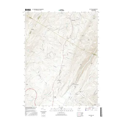
2016 Map of Old Fields
USGS Topo · Published 2016About this map
Purgitsville and the southern reaches of the South Branch Potomac River dominate this modern landscape where the borders of Hampshire, Hardy, Mineral, and Grant counties converge. The terrain is defined by the sharp ridges of Patterson Creek Mtn and Mill Creek Mtn, creating a series of narrow valleys where agriculture and small settlements like Old Fields and McNeill persist. A notable topographic landmark is The Trough, a deep gorge through which the river flows, flanked by River Ridge and Sawmill Ridge. Local genealogy is well-supported by the location of several burial grounds, including Old Pine Cem, Green Hill Cem, and Bethel Cem, while numerous springs such as Welton Spring and Fluke Spring indicate the hydrology of this limestone-influenced region. The road network follows the ancient paths through breaks in the mountains, most notably at Reynolds Gap.
Find a feature on this map
101 named features on this map. Tap any name to fly to it.
Don’t see what you’re looking for? This feature index may not catch every label — zoom into the map to look around manually.
Map Details
Editions of this 2016 Old Fields Map
This is the sole edition of this map. No revisions or reprints were ever made.
Other maps of this area

1891 · Romney
USGS Topo · 1:125,000

1895 · Piedmont
USGS Topo · 1:125,000

1919 · Elk Garden
USGS Topo · 1:48,000

1920 · Elk Garden
USGS Topo · 1:48,000

1920 · Moorefield
USGS Topo · 1:62,500

1920 · Keyser
USGS Topo · 1:62,500

1921 · Keyser
USGS Topo · 1:48,000

1921 · Greenland Gap
USGS Topo · 1:62,500

1921 · Moorefield
USGS Topo · 1:48,000

1922 · Elk Garden
USGS Topo · 1:62,500