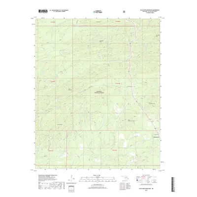
2018 Map of Old Glory Mountain
USGS Topo · Published 2018About this map
Ouachita National Forest dominates this landscape in McCurtain County, defined by a series of prominent peaks and the intricate drainage basins of the Lukfata Creek system. The terrain is marked by significant elevations including Old Glory Mtn, West High Peak, and the dual summits of West Government Mtn and East Government Mtn. These ridges separate the numerous branches of Cedar Creek and Carter Creek that carve through the timberlands.
Find a feature on this map
42 named features on this map. Tap any name to fly to it.
Don’t see what you’re looking for? This feature index may not catch every label — zoom into the map to look around manually.
Map Details
Editions of this 2018 Old Glory Mountain Map
This is the sole edition of this map. No revisions or reprints were ever made.
Other maps of this area

1902 · Lukfata
USGS Topo · 1:125,000

1950 · Mcalester
USGS Topo · 1:250,000

1959 · Golden
USGS Topo · 1:62,500

1959 · Broken Bow
USGS Topo · 1:62,500

1960 · Bethel
USGS Topo · 1:62,500

1960 · Smithville
USGS Topo · 1:62,500

1962 · McAlester
USGS Topo · 1:250,000

1965 · McAlester
USGS Topo · 1:250,000
1976 · Broken Bow SW
USGS Topo · 1:24,000
1981 · Hee Creek
USGS Topo · 1:24,000