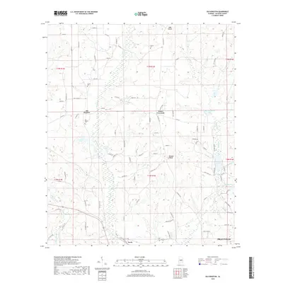
2018 Map of Old Kingston
USGS Topo · Published 2018About this map
Old Kingston and the surrounding rural landscape of Autauga County appear in this topographic study, anchored by a series of small crossroads settlements and family burial grounds. The terrain is defined by the winding course of Autauga Creek and its many tributaries, including Mill Creek and Bridge Creek. These waterways once supported local industry and agriculture, shaping the placement of early community centers like Poseys Crossroads and Mount Sinai. In the southern reaches, the growing outskirts of Prattville meet the established community of Booth, while the northern hills preserve older landmarks such as Wilsons Cemetery and Stewart Cemetery. This 2018 survey provides a clear look at how modern roads like County Road 42 and County Road 10 follow the historical settlement patterns established generations ago by Autauga County families.
Find a feature on this map
91 named features on this map. Tap any name to fly to it.
Don’t see what you’re looking for? This feature index may not catch every label — zoom into the map to look around manually.
Map Details
Editions of this 2018 Old Kingston Map
This is the sole edition of this map. No revisions or reprints were ever made.
Other maps of this area

1891 · Clanton
USGS Topo · 1:125,000

1901 · Wetumpka
USGS Topo · 1:125,000

1903 · Wetumpka
USGS Topo · 1:125,000

1927 · Montgomery
USGS Topo · 1:48,000

1930 · Montgomery
USGS Topo · 1:62,500

1953 · Montgomery
USGS Topo · 1:250,000

1956 · Montgomery
USGS Topo · 1:250,000

1957 · Montgomery
USGS Topo · 1:250,000

1957 · Autaugaville
USGS Topo · 1:62,500

1958 · Montgomery
USGS Topo · 1:62,500